Doksuri weakens to a TS over China, TS Khanun another potential threat
Doksuri has weakened into a tropical storm over China after its landfall as a Category 3 typhoon earlier today, but another storm may become a new threat to the country in the form of Tropical Storm Khanun.
Current information
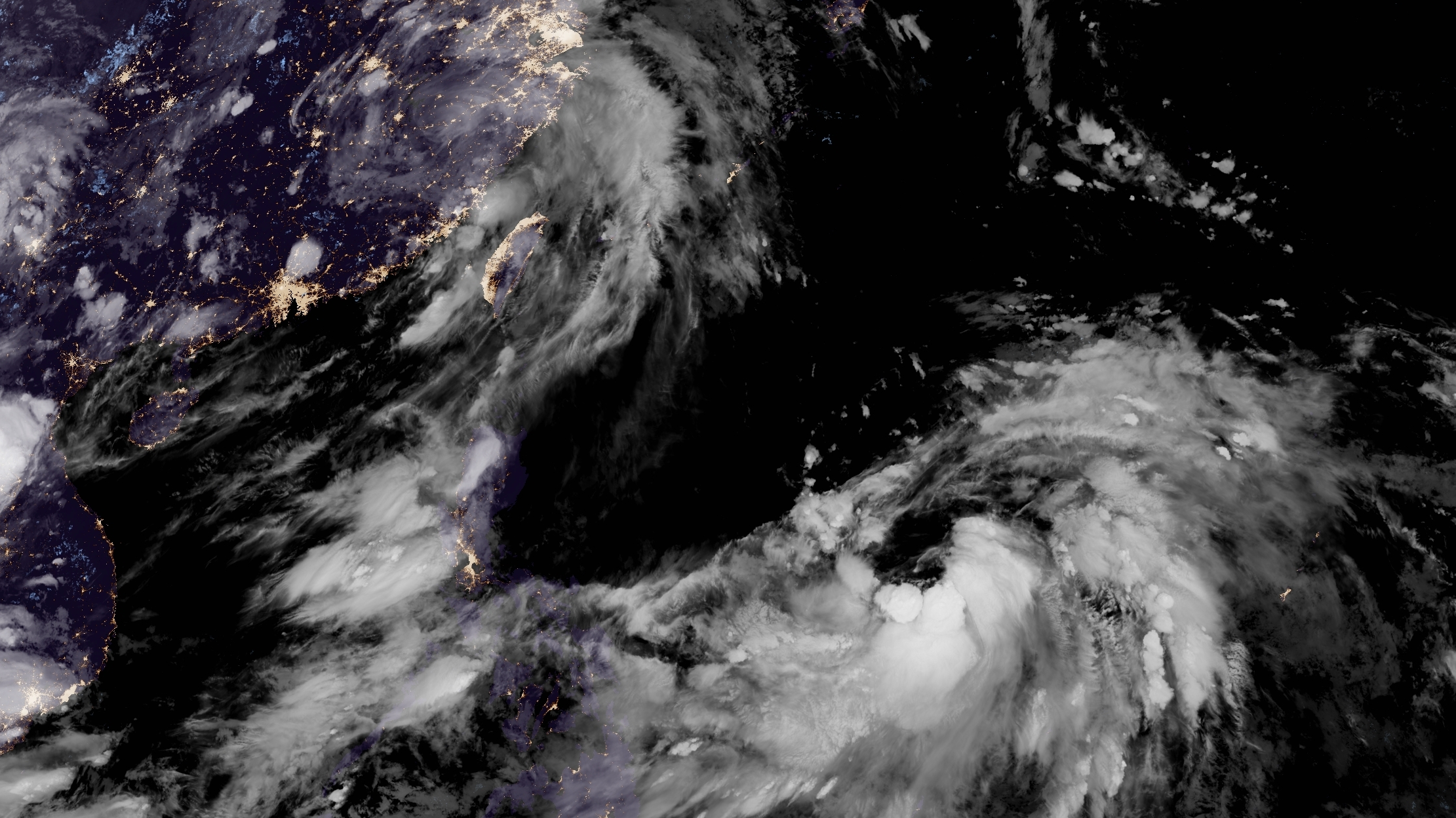
As of 8:00 pm China time (12:00 UTC), Tropical Storm Doksuri is located at 26.9 north, 117.9 degrees east, or in the vicinity of Sanming, Fujian. The Japan Meteorological Agency has the storm with 10-minute sustained winds of 75 km/h (45 mph), with gusts of 110 km/h (60 mph), and a central pressure of 994 millibars. The Joint Typhoon Warning Center, although it issued its final warning on the system, is continuing to track it as a tropical storm, currently with 1-minute sustained winds of 100 km/h (65 mph).
Tropical Storm Khanun is located at 14.2 degrees north, 135.5 degrees east, or about 340 miles north-northwest of Yap. The JMA has the storm with 10-minute sustained winds of 65 km/h (40 mph), with gusts of 90 km/h (55 mph), and a central pressure of 998 millibars. The JTWC also has Khanun with 1-minute sustained winds of 65 km/h (40 mph).
Force Thirteen currently has Doksuri with 1-minute sustained winds of 90 km/h (55 mph), which is slightly lower than the JTWC estimate, and a central pressure of 982 millibars, while Khanun has winds of 75 km/h (45 mph), which is slightly higher than the JTWC estimate, and a central pressure of 998 millibars.
Current warnings
The China Meteorological Administration has issued the following warnings for Doksuri:
- Yellow Typhoon Warning for Fuzhou, Ningde & Wenzhou, Fujian, and the entire province of Anhui; and
- Blue Typhoon Warning for Zhangzhou, Quanzhou & Sanming, Fujian, Quzhou, Hangzhou, Huzhou & Jiaxing, Zhejiang, and the entire provinces of Jiangxi, Jiangsu, and Shanghai.
There are no warnings currently in effect for Khanun.
Current forecast
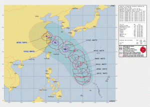
With Doksuri dying over China, Khanun looks to take over the stage in the Western Pacific. Although currently struggling to organize its broad circulation due to persistent northerly wind shear and mid to upper-level dry air coming down from the north and west, the storm is forecast to rapidly intensify on Sunday after dealing with its problems, with the current JTWC forecast calling for a major typhoon peak.
The system is then expected to turn west-northwest under the influence of a subtropical ridge lying in an east-west axis from Japan, to South Korea, and into northern China during this rapid intensification, and will likely come very near Okinawa by Monday next week, before slamming into Shanghai by Wednesday.
Khanun will likely step up its intensification soon, and as such, residents in Okinawa and eastern China need to monitor the system’s progression. Stay tuned to us as we continue to monitor both Doksuri and Khanun.
