New Invest Quickly Developing near Florida, Could Become a Brief Depression or Storm
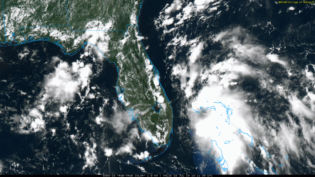
Invest 94L was designated yesterday over the southwestern Atlantic, which was a broad and ill-defined tropical wave at the time. Since then, it has traversed westwards into the Bahamas and has gained a lot more convection. In fact, it may be on the verge of becoming a tropical depression, and the NHC is giving it a 60% chance of doing so within the next 2 days as it approaches the Florida Peninsula.

While winds with the system do not breach gale force, the wind field has become defined enough that a closed low has potentially formed just off of Andros Island in the Bahamas. ASCAT data revealed 25kt winds in the eastern quadrant with westerlies to the south of the pressure center. Convection with the system has been blossoming because it is currently stacked underneath an upper-level anticyclone. This has formed in conjunction with a few other upper-level features, including two upper-level lows, one over the southeastern Gulf of Mexico and a stronger one north of Puerto Rico, and an upper-level trough over the Carolinas. Weak ridging has developed in the middle, which is also where 94L is also located. This area of favorability is rather small, however, so the system itself is not particularly large, but this may allow it to intensify with more earnest than it otherwise would.

In the short-term, 94L will likely to continue to intensify through tomorrow, as sea surface temperatures are extremely warm, shear is low, dry air is not present, and the upper low over the Gulf may allow for some slight baroclinic assistance. Regardless of how strong 94L becomes, it will not have very long to intensify. It has already started a gradual northwest turn in response to a cold front moving southward across the eastern U.S., bringing relief from this weekend’s intense heat. As the front approaches 94L, the invest should begin a northward turn along or just off the east coast of Florida, potentially as a tropical depression or weak tropical storm. As this point, conditions will become increasingly unfavorable for the storm. Because the system is not officially a tropical cyclone, its vertical extent into the troposphere is not very high, and the dominant southwesterly frontal flow is based within the surface. All of those weaker upper-level features will likely remain in place throughout the storm’s life, which will bring 94L out of its cocoon of favorability. As the front approaches, its parent trough will kick into the Great Lakes region, which will enhance the southwesterly flow in the upper-levels, inducing an increasing speed shear over 94L as it starts to turn northeast off the South Carolina coast by Tuesday night. At this point, it’s possible that the system may merge with the frontal boundary, completely reducing its chances of becoming a tropical cyclone, or dissipating whatever tropical entity is present.

However, even if 94L develops, the impacts from the system are expected to remain minimal. Rainfall totals from the system itself will likely not breach 2 inches, as the storm itself is small, quick-moving, and likely will be offshore. So unlike Barry, this is unlikely to produce flooding rains. If the system moves onshore, then rainfall and gusty winds may become more of a problem, but should still remain minimal. In fact, more rain is expected from the cold front in Florida rather than 94L. The front will beat 94L to the Carolinas, so even less of an impact is expected there.

Even though the impacts from 94L are expected to be minor, please still listen to advice from local officials and news outlets for the latest information for your specific area. If this system does become a tropical storm, it would gain the name “Chantal”. Remember that it’s only late July, so the majority of the season is still to come. Stay tuned to Force Thirteen for updates on 94L and all things tropics related.
