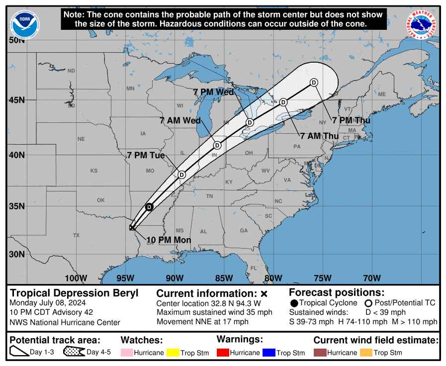
Mesoscale satellite loops on Tropical Storm Beryl are available here. We are currently experiencing technical issues receiving GOES-16, and GOES-18 satellite data.
A backup source with hourly data is in operation.


Ads by 
Mesoscale satellite loops on Tropical Storm Beryl are available here. We are currently experiencing technical issues receiving GOES-16, and GOES-18 satellite data.
A backup source with hourly data is in operation.

Ads by
GIF (a bit laggy)
Invest 90L might be a depression by tonight if it can organize.
Invest 90L now has tropical depression winds. Now it just needs to organize itself.
There is an other invest in the Gulf of Mexico!
High shear…
Come on Alberto!
Invest?
Definitely looks like it…
#2024IsBoring
Who is ready for 2024 Atlantic Hurricane Season? There is an invest by Yucatán Peninsula!
There is an unnamed subtropical storm by Spain it looks like.
Why won’t it be named? It is well organized and has wind speeds over 40mph.
Woke up this morning with literally nothing to track, today is going to be boring. #ComeOnAlberto
Who else has a bad feeling about the name Kirk this year? I am predicting it will strike as a Category 5.
Aletta
What website do you use?
Windy.com
Also, try using zoomearth.com for more info
I use zoom earth already.
hey guys i’m back + active 2024 season + come on alberto
alberto be a cat 1 plzzzzz
Alberto might not be a Cat 1, but it does look like it may become a strong tropical storm by how it looks on tropical tidbits. However, tropical tidbits always updates.
Also I see on tropical tidbits a second, potentially stronger storm hitting in the exact same spot. Do you think we will get Alberto and Beryl before the end of June?
no not really
How About now? There is another storm coming.
when will the wind shear ease off for the north atlantic?
IDK
94s Looks like it is headed for Madagascar, potentially as a major the way it is looking.
Probaly To Mozambique
i do see that stronger storms have higher wind shear value near their core, what is it called and how does it affect a storm’s intensity?
The outflow they produce has to do something with wind shear
Yes, all storms produce some sort of upper level outflow, which are shown as “wind shear” on our shear maps. They are however not detrimental to the storm’s development.
Also is anyone else watching a storm system in the Atlantic by Panama?
Why would they name it if it was just a depression?
The naming of Western North Pacific storms are handled by the Japan Meteorological Agency (JMA). This site uses data from the US Joint Typhoon Warning Center (JTWC) and they have it as a Depression, while the JMA have it as a Tropical Storm.
Hence, it is named as Tropical Depression MALIKSI.
Maliksi just got named!
That was quick
OOOOOOOOOOOOOOOOOOOOOOOOOOOOOOOOOOOOOOOOOOOOOOOOOOOOOOOOOOOOOOOOOOOOOOOOOOOOOOOOOOO